Westport in Brief!
EverythingWestport.com
Tuesday, March 16, 2010
Quick Article Index . . .
EverythingWestport.com
Tuesday, March 02, 2010 Photos/everthingwestport.com View photo album now! 11 photos | Dial-up speed | Broadband/DSL speed |
The National Weather Service reported gale
force winds of 30 to 35 knots with gusts up to 50. Seas of 8 to 11 feet in
Rhode Island Sound produced high surf, which littered cobble stones across
East Beach Road. High winds scattered debris and broken branches over
Westport roadways. Gale warnings had been issued through Monday. According to local sources close to 5 ½’ of
rain fell drenched the area. Just another typical March day in Westport! The town’s frontend loader was dispatched
Sunday to East beach to clear the ubiquitous cobblestones. Rain, heavy at times, encouraged flooding
in steams and low-lying areas. Part of Route 6 was actually under water
Monday. The Head of Westport was a raging torrent, rushing to the sea with
serious rain water runoff. The torrential rains battered Westport and pushed
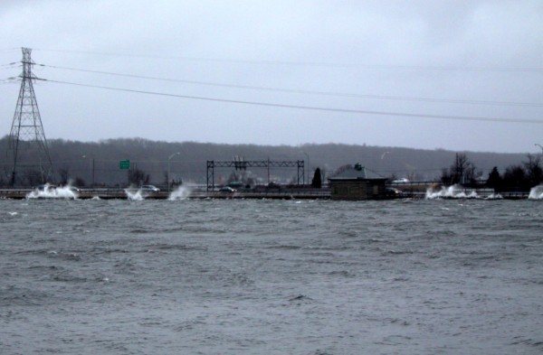
area dams to the limits. The angry nor’easter screamed like a
banshee as it pushed 3’ to 4’ choppy water from North Watuppa Pond onto the
Route 195 narrows, breaking over the protective barrier wall and spilling
onto the highway. It looked like a wild scene from a North Carolina
hurricane. Patchy fog completed the dismal picture
over the last three days. Fortunately, the northeast winds kept the
surf in check, reducing the cobblestone mess to a manageable level that the
Highway Department was able to easily clear without tying up traffic. But take heart; the Boston Globe observed Tuesday that if it had
been slightly colder we would have been buried under 80” of snow!
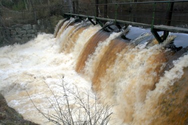
Top left: Forge Pond
dam emulating Niagara Falls; top right: Adamsville Pond overflowed its dam,
flooding the walkway and inundating the fish ladders; bottom: wind-driven
choppy water was breaking over the protective barrier onto Route 195 on the
south edge of North Watuppa Pond. - - - - - End - - -
- - © 2010 Community
Events of Westport All rights
reserved. EverythingWestport.com |